|
Tips to help you connect your family to nature!
|
|
Wherever you are, you are standing in a watershed! But, how do you explain a watershed to a 9 year old? Observation is a good start. A roof catches the water from a rain storm and as it runs off the roof, it flows into gutters, drainpipes and eventually into a barrel, or a storm drain in the street. Now, imagine the hillsides of a big valley being the roof of a shed, and the melting snow runs down the slopes into small streams eventually flowing into larger rivers. The area of land encompassing the hillsides is referred to as the watershed. From a bird’s eye view, drainage patterns in a watershed resemble a network similar to the branching pattern of a tree. Tributaries, similar to twigs and small branches, flow into streams, the main branches of the tree eventually to the larger tree trunk. Like all other branching patters (e.g., road maps, veins in a leaf), the drainage pattern consists of smaller channels merging into larger ones.
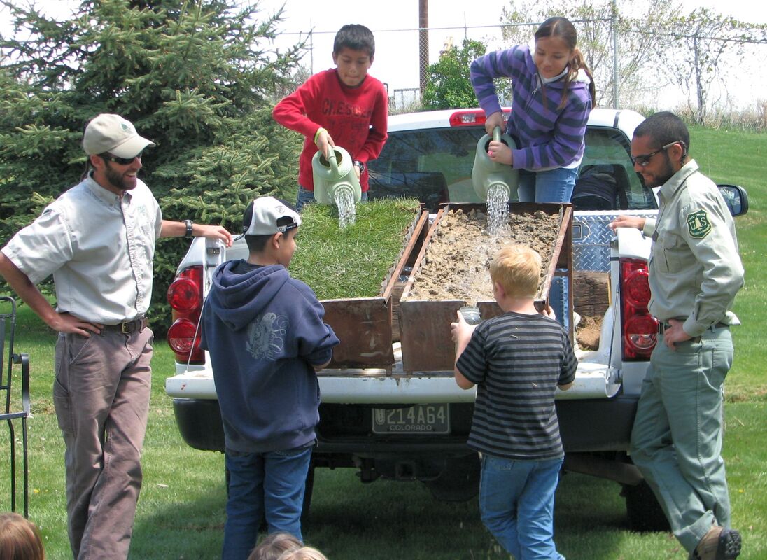
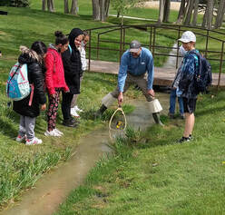
A watershed is an important concept! In the west, water availability depends on the amount of rain and snow throughout the year. In Colorado, the snowpack or total seasonal accumulation of snow on the ground is the predominant source of runoff supplying our major rivers with water. In this part of Colorado those rivers are: the Gunnison, the Uncompahgre, the San Miguel, the Dolores and of course the Colorado River. The last few back-to-back below average water years, started to build drought conditions which intensified with a dry spring and hot summer. Last summer was one of the driest years on record and created drought conditions that sparked some of the worst fires in our state history. Because of the consequences of drought, understanding and caring for our watershed becomes very important. Water availability is also dependent on the condition of the land within the watershed. Watershed health is a function of appropriate land uses which affect the amount infiltration, runoff, the quality of the water flowing into a river and ultimately what we drink! Local foresters often provide a very effective visual demonstration to help students understand how land use can affect water quality. Using 2 (half) culverts set on a slope, one with sod (substituting for trees shrubs, grasses) and the other with no plants, only soil; one student pours one gallon of water from the top of each culvert and their classmates capture the water that runs off the bottom of each culvert in a clear flask. Their observations? The water sample from the vegetated (sod) culvert is clear compared to the murky water sample from the non-vegetated culvert. Proof that vegetation slows down the runoff so the precipitation seeps into the soil. The roots of the plants function as a filter catching the sediments and nutrients, ultimately providing better quality water. Land use matters! Roads, housing developments, shopping malls, parking lots, timber harvesting, improper grazing and wildfires remove vegetation and can cause increased soil erosion which ultimately affects the quantity and quality of runoff within the watershed. Watersheds, river dynamics and western water management are such important concepts to understand that two non-profits and the Department of Natural Resources (DNR) have contributed funding to provide opportunities for students to learn about them. The mission of these entities are a bit different but all three encourage actions to protect our watersheds. “Forever Our Rivers” champions community engagement in river health, with efforts generating the interest, people power and funding needed for healthy river ways. “The Gunnison Round Table” (associated with DNR and the Colorado Water Conservation Board) is involved with water planning for current and future in-basin uses. Friends of Youth and Nature facilitates opportunities for youth to learn about the environment and become active stewards of our natural resources. All three have collaborated this year to establish funding to bring over 1200 students to events with interactive water learning activities on the Western Slope. “Water in the West” is the newest Colorado River Water interactive exhibit at the Eureka Science Museum in Grand Junction. The hydrology exhibit includes 12 different lessons about water, from turbulence and dissolved oxygen to measuring flow rate. Approximately 700 gallons of water flow through a 40- foot- long feature that mirrors the Colorado River. Water rushes through irrigation gates to orchards, flows through fish ladders, is diverted into dams and canals and is tubed away in a model of a transmountain diversion. A few weeks ago, fourth graders participated in the annual Montrose Natural Resource Festival sponsored by the Shavano Valley Conservation District. Groups of students rotated through stations where they learned about various natural resource concepts through demonstrations and hands-on activities led by resource specialists. Not surprisingly, many stations focused on aspects of water: Your Water – Your Watershed, explaining ways water users can cooperate to protect water resources (The Uncompahgre Watershed Partnership); The Importance of Trees in Our Watersheds (Montrose Forest Products) , A River Runs Through It – Simulating the dynamics of a river system in a big sandbox (Delta Conservation District), The Importance of Aquatic Invertebrates in the Food Chain (BLM/San Juan Mountain Association); The History of Colorado Water Laws and Why Measuring Flow is Important (Colorado Division of Water Resources), and, Preventing Pollution in our Watersheds (City of Montrose). The goal of these environmental education events is for our youth to learn how interconnected and complex our water systems are. The Colorado River Basin is huge, encompassing parts of seven U.S. states and two Mexican states. There are a myriad of land uses, and land conditions within this huge basin as it flows from its headwaters in the Rocky Mountains over 1400 miles into the mostly dry Colorado River Delta at the tip of the Gulf of California. Many people rely on that water for so many uses – drinking water, agriculture, industry, power, recreation and fish and wildlife habitats. Do we have enough water to share? How do you measure it? How do you decide how much everyone gets particularly in a drought? How is water stored? How much evaporates? Does dust on snow affect spring snow melt? How can you restore and protect watersheds? What are inner basin water transfers? Western Colorado students are introduced to a lot of concepts related to water in the west, and the more they know, the more questions they have! Mission accomplished- inspiring critical thinkers! Next time you have a conversation with a fourth grader, ask them why they think water in the west is so complicated? River Runner is a very cool water tool that tracks a raindrop anywhere in the contiguous United States! Watch where it ends up! Also, check out these fun watershed activities from Project WET (Water Education for Teachers)to demonstrate watershed concepts to students in the classroom: Color Me a Watershed Branching Out Make your own Watershed
0 Comments
Leave a Reply. |
Blogs for Summer! DIY Summer Camps A Summer backyard Bucket List Hiking with Children 101 Kids, Dogs and Hikes a Winning Combination Getting Outdoors is Easier than You Think Categories
All
Archive
Archives
July 2024
|


 RSS Feed


