|
Tips to help you connect your family to nature!
|
|
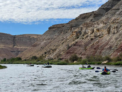
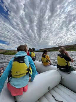
Cottonwood Elementary fifth graders embark on a 3 day rafting trip on the Gunnison River with Colorado Canyons Association. Transported by rafts and duckies students got a close up interaction with the river and learned of its history. (Photo credit: Doug Goodwin) On a brisk, but sunny day in late September my 5th graders circled up next to the Gunnison River. This was to be day one of three days over which all three of the 5th grade classes from Cottonwood Elementary School would go rafting on the Gunnison River to learn about river ecology, navigation, Native Americans, and hopefully, a bit about themselves. One of our guides from the Colorado Canyons Association led them on one of many team building activities for the day. “As you go around, say out loud your name and what kind of animal you feel like today.” The kids came up with great names for themselves. I said I felt like a border collie because of my teacher role of keeping everyone together. I would quickly find out though, we were in good hands with our guides for the day. After a thorough river safety talk the kids split up into boat groups, loaded up and hit the river. The day’s float would be on a beautiful class 1-2 stretch starting at the Pleasure Park and going 6 miles downstream. In addition to the 3 16’ rafts, we also had 3 inflatable two person kayaks known as duckies. Including myself, I was fortunate to have a couple brave parents to help rotate kids through the duckies and learn about how to pilot the smaller boats. As with most river trips, all the stresses of planning and preparation melted away once we were on the river. The miles slowly drifted by. Along the craggy cliffs kids kept an eye out for wildlife. Their keen observation paid off as they spotted several bald eagles either in flight or nesting within the crags. At a giant cottonwood tree, the kids listened intently as a former high school teacher turned river guide told them a Native American story about the stars, and the trees and the spirits. From there we headed downstream to Eagle Rock Shelter-one of the oldest Native American sites in North America. Nearly 13,000 years ago this area was frequented by ancient people. The students learned about the Utes and other Native Americans who occupied the site. Looking carefully, students spotted dozens of both pictographs and petroglyphs among the contours of the rock. From there we headed back down the trail to the awaiting rafts, lunch, and more river time. The kids were in great spirts. Prior to loading up, they frolicked in the water like otters and laughed, and lived the river life. In all too short of a time, we were at the takeout. Under the direction of our guides, the kids helped organize their life jackets, got their packs out of the dry bags said thanks and loaded up on the big bus. I want to thank a variety of people who helped make this trip possible for our 5th graders. First off, the Colorado Canyons Association, who worked with us on pricing and scheduling-not to mention their professional, informative staff. Also, the students and parents helped. For several weeks leading up to the trip 5th graders worked hard in the mornings before school selling pickles to help raise money. Friends of Youth and Nature contributed a sizable amount to help get our kids on this trip. The Upper Gunnison River Water Conservancy District and Forever Our Rivers also helped us. In addition to this, the Montrose Rotary Club pitched in. Last, but not least, the Cottonwood Elementary School PAC gave us the final financial push to make this trip possible. The importance for students to experience trips like this cannot be understated. Many students-including myself as a youth, thrive in outdoor settings. They realized that learning happens all around us. Students gain confidence from outdoor experiences and this confidence can transfer to other learning avenues. As a former river guide and outdoor education instructor, it was incredible to get our students on the river and give them an opportunity to experience something many of them had no idea existed. I know with our students that seeds of curiosity were planted and that their learning will continue to grow-both in the classroom and outside. Students enjoyed their float on the river (photo credit: Doug Goodwin)
4 Comments
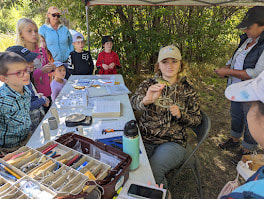
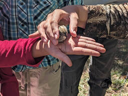
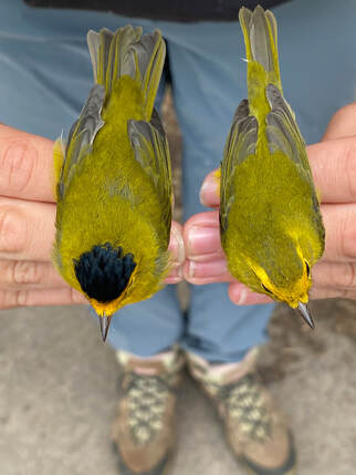
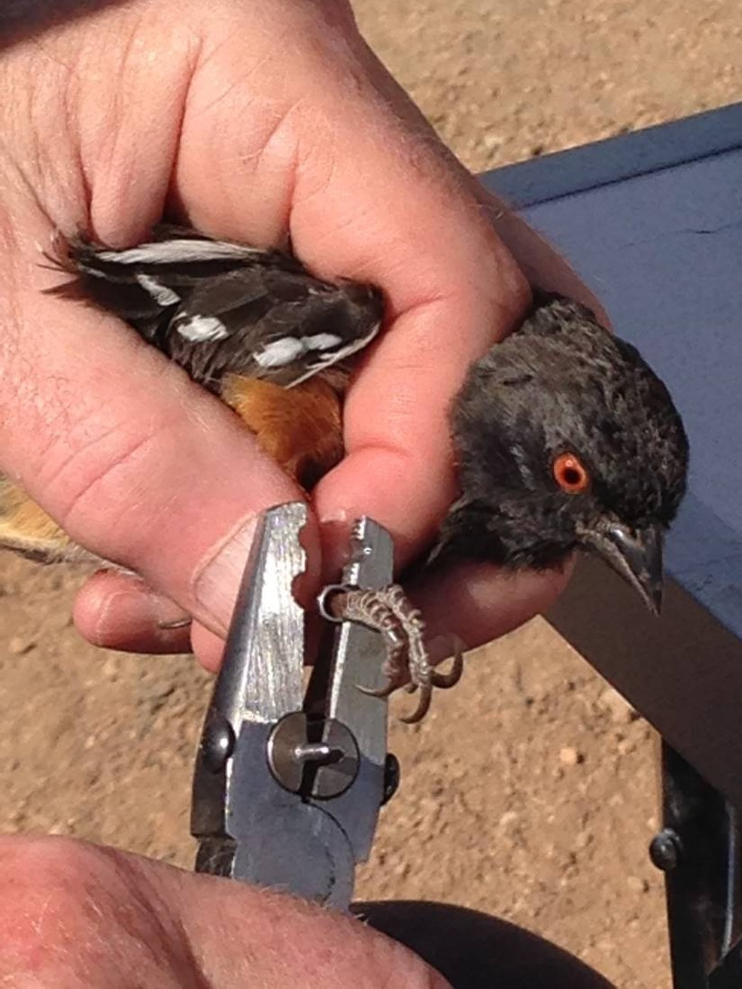
(Left) Students from local schools visit Ridgway State park during the banding season to learn about bird migration. They observe the biologist remove the birds from the mist nets, identify the species, measure and age them, and fit them with numbered metal leg bands. They also learn about the obstacles for migrating birds, how to use binoculars to identify birds, and native plants in various local bird habitats. (Right) It is always a thrill for a student to release a newly banded bird. Migratory birds take cues from nature to know when they should head south for the winter. Typically, these are birds that depend on insects and aquatic life as their primary food sources—food sources are not available during winter. In spring, the birds return to their northerly breeding grounds where food is again plentiful. It’s thought that diminishing food sources, fewer daylight hours, and lower temperatures provide birds with indicators they need to begin fall migration to warmer climates. It may also be that many species of birds are genetically programmed for this behavior. Because birds can’t tell us the reasons they migrate or when, wildlife biologists track bird migration a variety of ways. In addition to live migration maps that use radar imagery to identify vast populations of birds migrating during spring and fall (visible online at Birdcast.info), observers on the ground verify the radar imagery as they report sightings of migrating birds using Ebird. Both of these citizen science applications are important for gathering migration data, but bird banding and nano-tagging are even more important indicators of migration. On the ground tracking also occurs at seasonal migratory bird banding stations. In Colorado there are at least a dozen banding stations. At these stations, ornithologists operating under federal banding permits, set up mist nets and capture birds to be banded. After applying a permanent aluminum leg band with a nine-digit number, birds are released; but, not before a thorough evaluation is completed. This includes wing and tail feather measurements, weight, sex and species identification, and aging. All of this data is logged online on the US Geological Society’s North American Bird Banding Program’s website, where anyone can report a found bird with a leg band to determine where and when it was banded. Some stations are now fitting migratory birds with tiny Motus radio-transmitter tags attached to a lightweight elastic harness. The harness fits over the feet and across the bird’s back under feathers and carries a geolocator tag about the size of a pinky fingernail. Like an aluminum leg band, the tags are numbered and recorded for specific birds. When a bird is caught in a mist net, the banding team will log the recapture and look up when and where it was originally banded, thereby gathering basic information about migration. Motus tags, while expensive and not yet widely used, transmit better data to researchers looking at migration routes, stopovers, and final destinations. All of which provide important data sets to help conservation of migratory species and their necessary habitats. Birds, bats, and, even insects, that have been fitted with Motus tags can be monitored if they fly within a few kilometers of a Motus receiver tower. The Motus system puts information gathering on the fast track. Instead of relying on a bird to actually land in a net multiple times, in one country or another, tagging and tracking birds with nanotags allows real-time monitoring of species. About Migratory Bird Banding Stations Depending on the stopover location, the weather, and the quality of habitat, birds can stay for a few days or a week or two—enough to get them ready for their next travel day. Locations rich in habitat and food sources provide the best locations for banding stations. Ridgway State Park, which has hosted an annual fall bird banding station since 2006, sees a lot of Wilson Warblers (and other warblers) during its banding season. The station is open the first two weeks of September, starting the day after Labor Day. After that, the federally-permitted bander heads to Grand Junction for one month of banding at Grand valley Audubon Nature Preserve, Connected Lakes, until mid-October. Stop in to see these tiny little birds up close and personal at a banding station. Wilson Warblers leave breeding grounds in the Yukon and travel to wintering areas in Central America. On each stopover during its +4000-mile journey, a bird will gain up to 9 percent of its body weight to fuel the next leg of its flight. To date, banding stations on the Western Slope of Colorado are not nano-tagging migratory birds, but are expected to in the future. Stations in Montana and Canada are using them in limited capacity. Mary Menz is a naturalist, Colorado Native Plant Master, and author of two books on wildflowers. The most recent is Wildflowers of Colorado’s Western Slope, available at area book sellers. |
Blogs for Summer! DIY Summer Camps A Summer backyard Bucket List Hiking with Children 101 Kids, Dogs and Hikes a Winning Combination Getting Outdoors is Easier than You Think Categories
All
Archive
Archives
July 2024
|


 RSS Feed


