|
Tips to help you connect your family to nature!
|
|
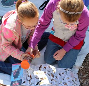
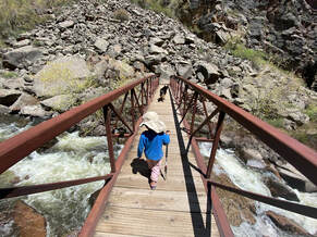
Nature guides are a great way to identify critters. These girls are using a bird guide to help them identify local birds likely to be seen along the Gunnison River. Colorado is famous for its great outdoor activities. Many of these activities require money or experience to get involved. Snowboarding, rock climbing, climbing 14ers, or riding snowmobiles or ATVs require both. Getting started in outdoor activities can be easier than you think, though. It is widely known that being outdoors helps our physical and mental health. So, here are a few easy and cheap ways to get outside on your own, or with others. Hiking: One of the best outdoor activities to start with is hiking or trail walking. The only real required equipment to start is a good pair of shoes. This cannot be stressed enough. Poor fitting or flimsy shoes can result in some frustrating experiences like blisters and sore feet. It can also result in safety issues from poor footing in steep or slippery trail areas. This does not mean you have to purchase expensive hiking boots or shoes, but sturdy, well-soled shoes with a good fit will be comfortable and safer. Next, and very importantly is to know where you are going. The COTREX app is a great trail application that has many hiking, biking and other trails all over Colorado. It includes important trail information such as distance, elevation changes, surface etc. Second, start with trails closer to your community because these are typically well signed and shorter. These will help you get a sense of how you feel on a variety of distances in different topography. Bring water and extra clothing layers for changes in temperatures. Before you know it, you will have gained experience, stamina and a little more equipment. You will be ready for longer day hikes on our public lands. Some of the most memorable experiences are being outdoors and seeing, hearing, smelling, or feeling nature around us. A short trail walk in the same location in winter, spring, summer and fall will result in amazing differences in what you experience. Tracks and Scat Hunting: It is surprising how many species of wildlife are close to, and even inside, towns in Colorado. Recently, I was on one of the concrete trails early in the day in Montrose after a slight snow fall. I was excited to see fox tracks, and a beaver track including drag marks where the beaver had pulled a tree across the trail. In addition to small mammals and rodents, there are great bird and waterfowl tracks all around communities. Even more fun than tracks by itself, is to add scat identification. Identifying scat (or poo), and the creature associated with it, is a surprising amount of fun. Different families of animals will have different scat based on what they eat and how it is processed. Herbivore scat looks very different from carnivore or omnivore scat. In addition to tracks and scat, there are other ‘signs’ you can find like trees felled by beaver, or deer antler rubbings on trees, or the mud slide of a river otter. It is a little like a nature investigation. Best of all, there is no real cost to get started because track and scat guides can be pulled up online, obtained at many wildlife or public land offices, or you can also check out scat and track guides at your local library. As with all activities involving wildlife, the goal is to not disrupt the actual animal, so observe from a distance or just look for the sign and know they are around. Star Gazing: Similar to tracks and scat, astronomy guides are available as apps or online. You can also find printed materials at your local library. Make sure you have an app, or guide, that covers your location and the current time of year. The key to star viewing is clear night skies with as little ambient light as possible to not wash out the constellations (so get away from streetlights, vehicles, etc). One of the easiest constellations to identify is the Big Dipper. National and state parks have astronomy programs you can also attend where the local astronomy clubs bring out amazing telescopes that bring the planets, comets, or other astronomical features more into focus. These and other programs also add information to make your future star gazing even better. Outdoor Discovery Apps If you have a ‘smart’ phone, you can also use several outdoor applications in outdoor discovery. Applications like Agents of Discovery, INaturalist, Merlin, geocaching and others are very user friendly, and allow you to choose what you want to focus on. Some have missions or challenges, others are to help id any type of natural item out there (plants, animals, rocks, birds, you name it!). Even though we all need less screen time, this is a way to be outdoors and focus on what is around us with the assistance of technology. In addition to the above recommendations, other cheap and easy outdoor activities can be as simple as flying a kite, or making our own ‘Outdoor Bingo/Scavenger Hunt’ where you can look for things like a rock the size of a toaster, any bug under a rock, or any bird with white and black feathers. Another recommendation is to find a mentor who is already doing things you are interested in, and ask them to show you how to get started. When I first moved to Montrose, a co-worker showed me all his favorite trails, and areas to hike or bike. Many of those trails mean a lot to me. I have since taken my kids and hopefully soon my grandkids out to the same areas. You don’t need to be an expert or wealthy to spend time outdoors, there are many ways to get started and the benefits are endless!
6 Comments
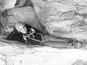
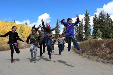
Spring is the perfect time for canyon hiking. There are plenty of canyons to explore in our local National Conservation Areas (NCAs), our nearby National Parks and Monuments and the Bureau of Land Management Public Lands. Kids love to scramble around the warm rocks looking for cracks and crannnies to explore. This one looks like a perfect fit! (Hannah Freed, Photo Credit: Christine Freed) Every day the weather seems to be gradually getting a little warmer (in between those spontaneous Colorado snowstorms, at least), and that can only mean one thing—spring is near! The transition from winter to summer activities will be here before you know it, and it’s time to start planning some excursions with your little ones as the trails dry and the warm sun comes out. The benefits of getting outside are numerous, from mental health, to physical health, to just having fun together as a family. Here are a few quick and easy hiking trails that you can enjoy with your whole crew: The Lunch Loops are always a crowd favorite. Less than 10 minutes from downtown Grand Junction, and with ample parking, access doesn’t get much easier than this. The most accessible trail is of course the paved one—the Monument Trail runs alongside Monument Road all the way from the intersection with Broadway up to the Lunch Loops parking lot, and in 2024 it will be extended all the way up to South Camp Road. If you’d rather get off the pavement and onto dirt trails instead, there are numerous possibilities at the Lunch Loops. For the very easiest hikes stick close to the parking lot on trails like Short and Cranky or the Kids Meal Loop. For a more strenuous hike head up Tabeguache for an out and back, or take Hop Skip and Jump to Big Sister for a short loop, with a few steeper parts, but rewarding views. Wherever you hike at Lunch Loops just be sure to keep an eye out for mountain bikers and dogs, as there are always a fair number of both on these well-loved local trails. Heading up towards the Colorado National Monument, a very popular option for a short hike is the Devils Kitchen Trail. Note that there is an entrance fee required, since this is within the Colorado National Monument. This trail can get crowded, but unlike the Lunch Loops, you don’t need to worry about dogs or bikes on the trail since neither are allowed within the Monument. The trail is just under 2 miles, and it’s an out and back (so you’ll come back the same way you headed in); there is some mild elevation gain, but it is very approachable for most casual hikers. If you make it up the full length of the trail, you will be rewarded with beautiful views and some really cool rock formations! If you’re looking for a hike with a big payoff for your mileage, the Mica Mines Trail should rank high on your list of must-dos. Another out and back trail, this starts at the Bangs Canyon Trailhead up Little Park Road, and takes you about 1.3 miles in (one way) to a very cool historic mica and quartz mine. The glittering, shimmering mica in the rock amphitheater formed by the long-closed mining operation is sure to be a huge hit with the kids! The trail is pretty flat the whole way, so it’s a very easy hike for anyone to enjoy. By the time you’ve reached the mine and made it back to the car, you’ll have hiked about 2.6 miles on flat terrain, which should be approachable for most families. The mine was operated up until the 1950s, and the mica that they were mining at the time was used for manufacturing paints and electrical insulation, so you can build a little history lesson into your excursion! One of the coolest hikes in the Grand Junction area is the Monument Canyon Trail, with the added benefit of getting to experience the Colorado National Monument without having to pay the entry fee (remember to leave the dogs at home since they aren’t allowed in the Monument). The parking lot for accessing this trail can be found by searching for Monument Canyon Trailhead, as it enters the Colorado National Monument interior, rather than taking you along the upper rim of the Monument. This one can be a bit of a step up in difficulty, being quite a bit longer than the other options, but you can always turn around part way if you don’t want to hike the whole ~5 mile loop. If you do make it all the way, though, the payoff is huge—literally! Aside from a high likelihood of getting to see some desert bighorn sheep, this trail leads, you right up to the incredible Independence Monument rock formation, which towers 450 feet above the desert floor. This formation was first climbed all the way back in 1911 by John Otto, founder of the Colorado National Monument, and shortly thereafter by Beatrice Farnham, to whom Otto was briefly married. If you look for a large, slightly sloping flat rock a few hundred yards northeast of the rock tower, you can still faintly see a giant inscription of the first line of the Declaration of Independence, which was carved into the rock by Farnham. Venturing a little further afield, the Dominguez Canyon trails can offer a real wilderness experience. About 20 miles south of Grand Junction, the trails here offer a long, flat hike that will take you as far as you’d like to go. The entire Big Dominquez and Little Dominguez Canyon Loop stretches for an astonishing 39 miles, but the vast majority of hikers just travel in as far as they want to go for the day, and then head back out. Little Dominguez Canyon has some very cool historical features, if you’re willing to do about 7 miles of hiking in total. Around 3.5 miles in, a homestead from 1911 has been preserved by the BLM and offers a fascinating look at life over 110 years ago. The house is remarkably well preserved, and the skeletons of old farming equipment are still dotted around the property. It’s really something worth seeing! The whole of Little Dominguez Canyon is beautiful, with astounding rock formations throughout, and it’s not at all uncommon to see desert bighorn sheep roaming along the hillsides. From the very easiest of hikes, to something a little more adventurous, but still approachable, this should give you a good start as you begin planning for some warm spring days hiking and enjoying nature with your family. Start with something easy and work your way up to the longer hikes, and before you know it you and your kids will be skipping up the most beautiful and rewarding trails on the Western Slope. Get out there and explore, spring is almost here! Students from Paonia Elementary enjoy a fall hike on the Grand Mesa National Forest. It can be a bit daunting to choose an area to explore with kids in our nearby national forests, to say nothing of deciphering maps and determining appropriate trails for youngsters. Between the White River, and the Grand Mesa, Uncompahgre and Gunnison National Forests, there are over 5 million acres of U.S. Forest Service lands here in Western Colorado; so vast that one may become overwhelmed with the plethora of opportunities. To narrow that down a bit I want to share with you my favorite “Hiking Gems” for kids here in our beautiful backyard on the Grand Mesa National Forest. As there are two counties splitting the Grand Mesa, I’ll give you a peek at hikes by county.
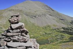
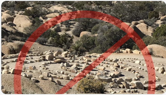
At the top of Delta County is the Land o Lakes Trail on the south side of Highway 65. This is a very short hike but gives the best view of Island Lake and the topography all around. Kids like it because it’s SHORT, handicapped-accessible, and it boasts not just a view but lots of trees and flowers to identify--don’t forget to bring The Rocky Mountains Field Guide reference book or tri-fold, both of which are available at the Grand Mesa Visitor Center. Also at the top of the Grand Mesa is the cross country ski area called appropriately County Line, which sits on the Delta and Mesa County Line. It’s advisable to do some planning by visiting the Grand Mesa Nordic Council website (gmnc.org/trails/skitrails) where you can print the map for all three ski areas. For the kiddos, I recommend the easy hike around the dog loop trail for a wonderful woodland experience, or the Overlook Trail for those able to cover more distance. The San Juan and Raggeds Mountain vistas are gorgeous from the overlook viewpoint. Mountain biking on the County Line Ski Trail system is also great fun for those of you who love the sport. I recommend reaching out to COPMOBA for recommendations based on the age and skill of your kids (www.copmoba.org). The most famous of the Grand Mesa trails is the iconic Crag Crest Trail found just up the hill from the visitor center—there is a Crag Crest parking lot sign on Highway 65, so you can’t miss it. Crag Crest is renowned for the views, the wildflowers, trees, and the varied landscape. In fall, the golden, fiery orange leaf colors can be simply gorgeous. The almost 11 mile loop may be too much for most youngsters, and even the 6 mile one way trek can be a lot. But, no one says you can’t hike out of the parking lot and up the trail as far as you want to go—you might just get close enough to the rocky top to really take in the beautiful vistas. It’s truly an exhilarating hike for everyone! Also on that side of the Grand Mesa is Island Lake. There you find a well-marked shoreline trail, taking off directly across from Island Lake Campground and going along the south side of the lake. Due to some higher-than-normal winds in past years, there are still downed trees. , but they’re easy enough to climb over or hike around. Watch for informational signs that tell fish stories that are indeed true AND remarkable. Access the trailhead via Forest Service Road #110, and park just past the trail entrance in the boat ramp parking area. In addition to the lake trail, you can walk into the Island Lake Campground and over the hill to the east where you’ll find Little Gem Lake with beautiful wild grasses, wildflowers, and peaceful waters just perfect for skipping stones and picnicking. Or, take a walk all the way through the campground heading south. There you’ll find an improved off-road vehicle lane to the Granby Reservoirs with many lakes on this 8 mile one-way hike. Consider it an all-day affair; go the distance or just a little ways, and toss in your fishing line when you stop for lunch. It’s easy walking! . The visitor center boasts the super kid-friendly Grand Mesa Discovery Trail. It departs from the visitor center and travels through woods and meadows, providing views of two lakes, seasonal wildflowers galore, and a few panels with nature information along the way (be sure to pick up the Discovery Trail pamphlet before you head out). The trail is only a third of a mile, so even the littlest can participate. While you are there, make a stop at the visitor center to learn the facts, history, and some of the excitement that Grand Mesa has to offer. The turn-off to the visitor center continues on to the Ward Way picnic area just past the campground. There you can pick up the Baron Lake Trail which passes Alexander Lake and takes you to Baron Lake. Its 1.3 miles one way but there are two places to stop and throw in a line. Or just rest a spell and examine the bug and fish life in the two lakes. Shore access is unhindered, and an easy spot for kids to play and explore. Now let’s go hiking on the Mesa County side, starting at the top and working our way down. As previously mentioned there are some great hikes following the ski trails, and while the Sky Way Ski Trail system of the Grand Mesa Nordic Council has more ups and downs and rocky business, it has a completely different view. Again, print out the map online and follow the trail to the Sunset Overlook. It’s just so gorgeous on a blue sky day in the fall—you’ll be looking down off the Mesa towards all the geologic outposts of the Bookcliffs on the Grand Junction side of the mountain. So worth the view, and it will be a new view to those who are not skiers in this area. Down the hill a bit is the Mesa Lakes and Jumbo Lakes area. There are multiple hikes in the area, all of which are kid-friendly. Turn into the Mesa Lakes area to access the 1.5 mile Mesa Lakes Shore Loop Trail. Stop for a toe dip in the cold water. This trail intersects with Lost Lake Trail for an additional 1.5 mile hike. This is one of my very favorite hikes to take with kids. It’s a bit more challenging than the Shore Trail. You can cut off the beginning hike by driving to the Glacier Springs picnic area at the same turn off as Mesa Lakes. Here the fun begins over basalt fields and through forests, and finally to the hidden gem of Lost Lake. While you are here, call out for an echo, cast out for a fish, or just get out your pen and paper and write a few Lost Lake inspired haikus. It’s a truly lovely place. Further south is the turn off for Jumbo Lakes Campground with two big pools of water: Jumbo Reservoir and Sunset Lake. The campground is between them and has parking. It’s a super fun outdoor playground for kids with creeks, bridges, lakes and varied terrain to explore. There are lots of stone skipping possibilities as well. If you are interested in a longer moderate level hike with lots of different terrain you can take off from the Mesa Lakes area on the Glacier Springs Cut-Off trail and head out to the Rim View Trail, or you can start at Sunset Lake in the Jumbo Lake Campground area and hit the Rim View Trail. It’s an out and back hike with wildflowers and rocks, and the ultimate view as you get past the connector trails. Bring your lunch and plan a picnic on a viewpoint of your choosing—you will not be disappointed. For the ultimate adventure with your kids, I’d like to recommend a one day backpacking trip. In actuality you can go for a couple of days on this trail if you wanted. Just off of Lands’ End Road you’ll find Carson Lake area and by taking the footpath across the dam you’ll find the Kannah Creek Trailhead. Hike downstream on the trail until you are tired and have gone far enough (considering it’s an uphill climb out in the morning). Find a flattish spot near the creek and set up camp. My grandson still considers this his most “wild” adventure and can’t wait to show this quick overnight out of doors adventure to his younger sister. The Kannah Creek Trail goes all the way down the mountain, but I don’t recommend it for the kids. The sounds of the wind in the tall trees, the water rushing down the mountain, the birds, and the crackling fire (when safely constructed and extinguished) make for a perfect, easy, fun introduction to backpacking. Most of this trail information and maps can be found on line at https://www.fs.usda.gov/Internet/FSE_DOCUMENTS/stelprd3812898.pdf with a printable brochure and map. Included on the map are road and route numbers. I’ve hiked all of these trails and I know you and your young folks will enjoy getting outdoors to discover the hiking gems of the Grand Mesa. Don’t be daunted by the vastness of our forest service lands—you got this, so get out there, and bring the kids! 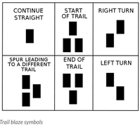 We are so fortunate to live in a place surrounded by public lands here in Western Colorado. Lands open to the public include National Forests, Bureau of Land Management areas, National Parks, portions of National Wildlife Refuges and Colorado State Parks and Wildlife Areas. Within most of these areas, there is a vast array of established trails open for you and your family to access. But once you’re hiking on the trail, how do you know if you’re following the right path? Once you choose an area to explore and you have selected a trail on a map, or from one of the many trail apps such as COTREX (Colorado Trail Explorer), knowing how to identify trail markings will help guide you on the trail you intended to be on - a key factor in having an enjoyable outing. There are numerous trail markings that help you know you are on the right trail. Most trailheads will have an information kiosk with a topographic map of the area and a “You Are Here” mark to let you know you are at the correct place. Other important information will be provided on this information board, such as reminders about keeping your dog in control, or warnings of recent bear sightings. In addition to the path beneath your feet, most hiking paths in heavily wooded areas are marked with trail blazes on the trees along the trail. A traditional trail blaze resembles the lowercase “i” carved into the bark of a tree by an axe or a knife. These marks are falling out of favor for environmental reasons but are still found on older established trails. More recently developed trails are marked with painted blazes. These are arranged in certain configurations to help you know where the trail leads: 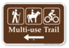 Here in Colorado, you also might see colored blazes indicating different uses of trails. Blue paint, poles, diamonds, or arrows on wooded trails indicate cross country ski trails. Orange paint, poles, arrows, or diamonds indicate snowmobile or ATV trails. Other trails, such as those on BLM land, national parks, and other public lands, usually have markers with universal international symbols indicating the approved use for that trail. Some trails will have multiple uses, so be sure to be aware if you are hiking on a trail that may also be used by bicyclists or horses. On multiple use trails, common sense should prevail with respect to trail etiquette. As a general rule, hikers and cyclists give way to horses. If you are in a desert or alpine area, trail markings called cairns, or simply stacked rocks, are often used to indicate the correct trail where it crosses barren landscapes and the path may not be clearly evident. Rock pillars have been used throughout history for navigation and marking sacred spots by people around the world. There has been a lot of discussion recently about making sure people do not construct random piles of rock for several reasons. In the back-country of Colorado, rock cairns are meant to be used for navigation without disturbing the natural environment. A constructed or complex rock arrangement, could cause confusion for other hikers as to the location of the official designated trail. These random arrangements diminish the wilderness experience, and violates the Leave No Trace principles followed by hikers and backpackers. Wherever you go with your family, make sure you always let someone know where you are going and “Know before you go.” Check in with the management agency about trail conditions and conditions of the roads accessing the trailhead. Be prepared! Make sure you have the 10 essentials in your daypack like water, food, extra clothing, raingear, a map, a headlamp, and a basic first aid kit. Then follow the trail markings and enjoy your time in Colorado’s backcountry!
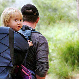 Let’s hit the trail with your “Littles” on three easy hikes close to home. Spring, early summer, and fall are glorious times to get outside and hike. Families with even the youngest of hikers can sometimes be flummoxed as to where to go to have a great experience. Appropriate distances and interesting easy terrain are needed—so, let me inspire you with three beautiful doable hikes in three counties here in Western Colorado. Mesa County boasts a super interesting, close-to-home hike for the youngsters: The Mica Mine Trail. The round trip distance is 2.6 miles and it’s rated easy. It includes some lovely shade and minor rocks to climb over, making it enjoyable for both adults and rambunctious kids. The trailhead for Mica Mine is shared with Rough Canyon and is right on Little Park Road (for a map and route description go to GJhikes.com). Why choose this easy short hike to get out with your kids? Oh so many reasons! There are some beautiful vistas of towering cliffs, and the trail crosses the tiny Ladder Creek enough times that everyone gets to hone their stone stepping skills if the water is running; there are many wildflowers, trees, shrubs, and birds to identify; and at the end there is the holy grail of mica! Enough slivered mica crunches under-foot at the mine itself that it can become a tactile fun science opportunity. No child has been disappointed in my experience. There was recently a rock fall near the trail, but it hasn’t hampered access, and it could be a good geology conversation about the rocky hillside’s “angle of repose” and potential triggers. Jumping into imaginative scenarios with kids adds to the fun as well. In Delta County check out the beautiful 3.2 mile (round trip) Crystal Overlook hike above the northern edge of the Black Canyon of the Gunnison (outside the actual National Park’s North Rim). Travel on Hwy 92 towards Crawford and keep going—eventually you’ll pass the turn off for the Black Canyon National Park, but stay on Hwy 92 through beautiful ranch country and finally onto the Black Mesa. Sixteen miles south of Crawford you’ll see the turn off and trailhead for Crystal Overlook. Park there and head on out on a well-traveled trail. At the trailhead there is a Curecanti National Recreation Area sign that depicts the trail as strenuous and 5 miles long. I beg to differ: it’s only 3.2 miles, and is an easy trail unless it’s very hot. There are three pitches where you will indeed feel the climb, but they are short. And, there are 3 benches for resting and viewing the San Juan Mountains along the way. Why choose this hike? The visual rewards are just exceptional and younger hikers definitely appreciate the sensory experience. Views of the West Elk Mountains, the San Juan Mountains, and the Cimmaron Valley are inspiring—and then it’s the destination that holds the most magic. The end of the trail is a safely guard-railed overlook down 1800 feet into the Crystal Reservoir of the Black Canyon. Keep on the trail to the very end. Your only choice point will be an unmarked fork that takes you up to a dead-end lookout point bench on the left, or you can skip that and stay to the right to get directly to the Crystal Reservoir overlook. Our favorite thing is to pack a picnic lunch and head out in the morning, enjoying our repast at the high overlook before heading back. Make sure to pack sunscreen and take water bottles for everyone. Montrose County is very special indeed. It encompasses all types of terrain, vistas, and levels of exertion for hikers. For the younger hiker we recommend the Black Canyon National Park’s aptly named Oak Flat Loop. This trail is within the park’s main south access and departs from the visitor center. Approximately 2 miles in length, it takes you to wonderful vistas of the canyon over mostly easy terrain amidst rock and gambel oak trees. Definitely take this hike counter clockwise so that the steepest part is in the downhill direction with a much easier ascent. You don’t go to the bottom of the canyon—but you do get to beautiful views, and shady areas that do not obscure the sightline, plus you are away from the large groups of visitors in other areas of the park. Why choose Oak Flat Loop? The river and rock vistas; the “below-the-rim” experience; the sense of adventure; eagle and peregrine falcon spotting across the canyon; and the shade. Three counties, three beautiful hikes. A great way to get out there close to home and introduce the younger generation to the experience of Mother Nature’s rewards. Take a hike, and take the kids! Color Sunday has come and gone, and less dependable weather makes it harder to get outside with children. Luckily many local parks are easy to access and provide the means to experience nature safely close to home. This can be a family fun challenge: create a parks checklist and have a goal and reward for getting to them all!
Mesa County: The City of Grand Junction Parks and Recreation Department has a wonderful resource listing all 36 parks alphabetically in the Grand Junction area (https://www.gjcity.org/residents/parks-recreation/parks/). Under ‘Parks” click on each park name and it will give you specifics about the size of the park and amenities available. For example, Autumn Ridge Park is a smaller park of 1.5 acres with picnic tables and grills; Canyon View Park is 110 acres with sports fields, playground, shelters, trails, restrooms and more. Fruita has a similar website (https://www.fruita.org/parksrec/parksites) that describes each of its 12 parks including a bike park with beginning and intermediate skill-building bike pump tracks. The section on this website under parks and trails lists popular hiking and bike trails, giving you the opportunity to take in gorgeous scenery and local wildlife. On the east side of the Grand Valley, several five-star parks are available in Palisade. Enjoy walking or riding bicycles under the trees along the paved path at Riverbend Park, having a picnic near the play equipment at Veteran’s Memorial park, or romping in the green space at the Palisade Community Center park. Addresses can be found by googling Parks and Recs near Palisade, CO. Montrose County: The City of Montrose website (https://www.cityofmontrose.org/266/Parks-Trails-Sports-Facilities) lists 29 fabulous parks, open spaces, concrete and single-track trails, and a water sports park. By clicking on the ‘interactive map’ and ‘view larger map’ you can see each park with amenities, including the 4.25 acre Montrose dog park located in Cerise Regional Park where you can let Fido play in a safe fenced-in area. Six parks in and near the town of Olathe are listed on their website (http://www.townofolathe.org/town-of-olathe-parks.html). A variety of facilities are available from Olathe Community Park at the south end of town to the Onion Park on Olathe’s north side. The Olathe Town park on 5th street has a spectacular new playground purchased through a Colorado Health Foundation grant. Delta County: The City of Delta has 11 parks on their interactive map (https://cityofdelta.net/parksites). Clicking on the name of the park, either on the map or on the list provided, takes you to a detailed description of each fabulous park, including year of establishment and amenities present. The North Fork area includes a listing of 18 parks near the towns of Crawford, Hotchkiss, and Paonia (http://www.northforkrecreation.com/parks.html). These descriptions include the Black Canyon National Monument and Crawford State Park, as well as the Delta County Fairgrounds adjacent to the Doctor Maloney Nature Park and its new disc golf course. Crossroads Park next to the North Fork Pool on Bulldog Street, has two new bike skill-building pump tracks, as well as single-track trails maintained by the North Fork chapter of the Colorado Mountain Bike Association (COPMOBA). The Surface Creek area, including Orchard City (Cory, Austin, and Eckert) and Cedaredge, have some beautiful parks and recreation facilities. Information can be found on the internet about these facilities: Orchard City Town Park (https://www.orchardcityco.org/36/Orchard-City-Town-Park), Cedaredge Town Park (350-398 SW 2nd Ave, Cedaredge, CO 81413), and the Surface Creek Trail in Cedaredge (https://www.hikingproject.com/trail/7058563/surface-creek-trail). These are just a few of the great variety of outdoor resources available close to home. Remember to obey local park rules and be respectful of others’ nature experiences. Get outside with your kids and enjoy all these amazing parks have to offer! Color Sunday, September 29, 2019, is just around the corner, and with it come the opportunities to get out into nature and experience the amazing yellows, oranges, and reds that come with aspen fall foliage. Aspen trees are amazing for more than just their beautiful leaves. They provide winter feed for elk and habitat for black bear and other species unique to Colorado. The following are three of our favorite family hikes on nearby public lands. Pick a trail near you or go to the FOYAN website for more hiking ideas in your backyard.
www.friendsofyouthandnature.org/maps.html If you live in or near Montrose, one of our absolutely favorite fall hikes with children lies just to the south near the town of Ouray in the Uncompahgre National Forest. An easy 3.5 mile loop combines the Portland Trail with a portion of the Upper Cascade Falls trails. It explores the basin below a huge amphitheater of eroded cliffs rising through mature aspen trees above the eastern side of Ouray and features scenic viewpoints to appreciate this formation along with the peaks of the San Juan Mountains rising to the south and west of town. Our children always enjoyed looking for magic: bear claw marks on the aspen bark, feathers on the trail, and snail shells nestled in the rocks along the path. You can always soak off the trail dust in the Ouray pool afterwards! How to get there: From Montrose drive south on highway 550 for 45 minutes to Ouray. Continue past Ouray for about a mile to the Amphitheater Campground and turn left onto the campground access road. The turnoff is past the second switchback leaving town. Follow the paved road into the campground keeping left at all intersections. The trailhead, marked for the upper Cascade trail is located at the top of the campground. Check out more details about this hike, and possible extensions into a longer hike at: hikingwalking.com and search for the Portland Trail description, under featured destinations of Southwestern Colorado. Delta County residents can travel east to the West Elk Wilderness area taking the Kebler Pass Road (Colorado 12) towards Crested Butte. The Cliff Creek Trail, featuring a hike to Beckwith Pass, is a 4.7 mile round trip to the top of Beckwith Pass and back, and wanders through one of the largest Aspen groves in Colorado. This hike is rated moderate because of its elevation gain of about 1000 feet over 2.35 miles to the summit of the pass, but it is easy even for young hikers if you take it slow with a few snack breaks. The wildflower fields, mature aspen stands, and amazing views are worth the trip! This year the wildflowers have outdone themselves and are as tall as most hikers as you make your journey up this magical trail. How to get there: From Hotchkiss drive east on Hwy 133 to the Kebler Pass turn off, following Hwy 12 for 17.9 miles. You will pass the Lost Lake Campground turnoff and turn off on the signed Cliff Creek trailhead. Drive up the dirt access road for 0.2 miles to the trailhead parking area. A trail description and trail map can be found at www.hikingwalking.com under central Colorado featured trails, Beckwith Pass via Cliff Creek. Mesa County residents have the Grand Mesa National Forest right in your backyard! After driving up through the Pinyon-Juniper, Oak brush, and finally into the Aspen, you reach one of the most beautiful hikes on the Grand Mesa. The 2.8 mile Mesa Lakes trail loop begins at the Mesa Lakes Campground above Powderhorn Ski Area. You can add another 0.7 miles with a short out and back to Lost Lake, which involves a moderate climb with stunning views. This trail has the added value of fishing opportunities at Mesa Lake, South Mesa Lake, and Lost Lake. How to get there: From Grand Junction, head west on I-70 to exit 49 for Highway 65 South towards Mesa/Collbran. Go 25 miles to Mesa Lakes Lodge. Drive into the lodge area and turn left just before the cabins. Follow the paved road to a parking area just beyond the trailhead. A map and short description of the Mesa Lakes trail can be found on www.alltrails.com/trail/us/colorado/mesa-lakes-trail. Fresh air, exercise, family bonding, and exploring nature are just some of the benefits of hiking with your children. If you are at all uneasy about this family outing, here are a few tips and tricks that will help you have fun and ensure your kids will want to go again and again!
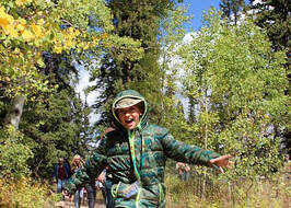
For the kick-off hike, pick an easy and interesting trail, go slow, and be enthused – it’s contagious! A destination hike can motivate kids to keep going to reach an endpoint - an overlook, cave, rock art, or waterfall. When you reach that point, have lunch, a special treat, or a fun activity like an energizing jump into a swimming hole. Also, at the end of your hike, have a good refreshing treat waiting in the cooler. Plan lots of stops to observe and play. The best kid-friendly hikes usually involve scrambling over rocks or boulders, wading through shallow creeks, or walking around a lake. Your kids can practice skipping stones, discovering aquatic bugs under wet rocks, naming wildflowers, or spying fish darting about. Definitely have dry socks and shoes at the car! Glance off-trail and look around often. A shiny object can get a curious child off course - that’s a good thing! Observation is a great skill, and improves with practice. The more you look, the more things you will see. Point out a lizard scurrying in the shade of a rock, a strange sound in the forest, the soft feel of moss on a log, the earthy scents of a decomposing log. Guide your child’s interaction with nature and try to appeal to all their senses. A hike can combine the best parts of being in nature – freedom, adventure and discovery. Take breaks often. Pick a boulder or a log to rest, enjoy the view, and have a snack -the best part of a hike! Pack lots of light snacks – nuts, protein bars, and fruit. Surprise your kids with a few unexpected incentives to keep them going like Skittles, gummy worms, or Smarties. Take more water than you think your family will drink and drink it often. Remain upbeat through the meltdowns and whines. Your kids will feed off of your energy, but be flexible. Change your plans if things are not working out. Remember that you are trying to introduce your family to a nature outing; they won’t want to go again if they aren’t having fun. When boredom sets in, distraction is the name of the game, and there are lots of trail games to keep everyone occupied and hiking. Your family is also having fun together! Here are a few to keep in mind.
Some additional trail tips:
|
Blogs for Summer! DIY Summer Camps A Summer backyard Bucket List Hiking with Children 101 Kids, Dogs and Hikes a Winning Combination Getting Outdoors is Easier than You Think Categories
All
Archive
Archives
July 2024
|



 RSS Feed


