|
Tips to help you connect your family to nature!
|
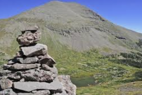
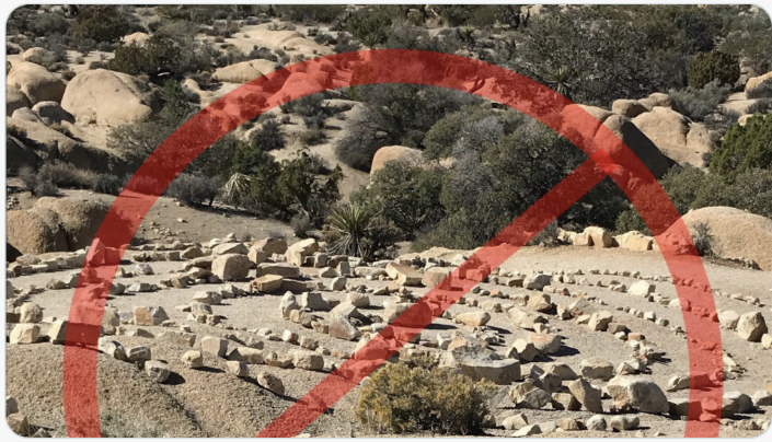
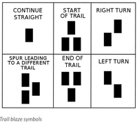 We are so fortunate to live in a place surrounded by public lands here in Western Colorado. Lands open to the public include National Forests, Bureau of Land Management areas, National Parks, portions of National Wildlife Refuges and Colorado State Parks and Wildlife Areas. Within most of these areas, there is a vast array of established trails open for you and your family to access. But once you’re hiking on the trail, how do you know if you’re following the right path? Once you choose an area to explore and you have selected a trail on a map, or from one of the many trail apps such as COTREX (Colorado Trail Explorer), knowing how to identify trail markings will help guide you on the trail you intended to be on - a key factor in having an enjoyable outing. There are numerous trail markings that help you know you are on the right trail. Most trailheads will have an information kiosk with a topographic map of the area and a “You Are Here” mark to let you know you are at the correct place. Other important information will be provided on this information board, such as reminders about keeping your dog in control, or warnings of recent bear sightings. In addition to the path beneath your feet, most hiking paths in heavily wooded areas are marked with trail blazes on the trees along the trail. A traditional trail blaze resembles the lowercase “i” carved into the bark of a tree by an axe or a knife. These marks are falling out of favor for environmental reasons but are still found on older established trails. More recently developed trails are marked with painted blazes. These are arranged in certain configurations to help you know where the trail leads: 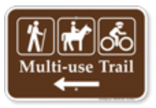 Here in Colorado, you also might see colored blazes indicating different uses of trails. Blue paint, poles, diamonds, or arrows on wooded trails indicate cross country ski trails. Orange paint, poles, arrows, or diamonds indicate snowmobile or ATV trails. Other trails, such as those on BLM land, national parks, and other public lands, usually have markers with universal international symbols indicating the approved use for that trail. Some trails will have multiple uses, so be sure to be aware if you are hiking on a trail that may also be used by bicyclists or horses. On multiple use trails, common sense should prevail with respect to trail etiquette. As a general rule, hikers and cyclists give way to horses. If you are in a desert or alpine area, trail markings called cairns, or simply stacked rocks, are often used to indicate the correct trail where it crosses barren landscapes and the path may not be clearly evident. Rock pillars have been used throughout history for navigation and marking sacred spots by people around the world. There has been a lot of discussion recently about making sure people do not construct random piles of rock for several reasons. In the back-country of Colorado, rock cairns are meant to be used for navigation without disturbing the natural environment. A constructed or complex rock arrangement, could cause confusion for other hikers as to the location of the official designated trail. These random arrangements diminish the wilderness experience, and violates the Leave No Trace principles followed by hikers and backpackers. Wherever you go with your family, make sure you always let someone know where you are going and “Know before you go.” Check in with the management agency about trail conditions and conditions of the roads accessing the trailhead. Be prepared! Make sure you have the 10 essentials in your daypack like water, food, extra clothing, raingear, a map, a headlamp, and a basic first aid kit. Then follow the trail markings and enjoy your time in Colorado’s backcountry!
1 Comment
|
Blogs for Summer! DIY Summer Camps A Summer backyard Bucket List Hiking with Children 101 Kids, Dogs and Hikes a Winning Combination Getting Outdoors is Easier than You Think Categories
All
Archive
Archives
July 2024
|


 RSS Feed


